Soil/Sediment Project Spotlight
Marion, MA
EST was contracted to perform a sludge sampling project at the Marion, MA Wastewater Treatment Facility. The Town of Marion uses (2) five acre lagoons and (1) ten acre lagoon behind its wastewater treatment plant to naturally breakdown sewage. There was previously a debate between the town and The Buzzards Bay Coalition (a private environmental organization) on whether Marion’s unlined lagoons were the sole contributor to excess nitrogen and if these lagoons were “leaking” to the exact level that the plant intakes. In 2014, the EPA issued Marion a draft National Pollutant Discharge Permit that instructed them to either stop using the lagoons or line them in order to comply with new standards. This latter option would consist of draining each lagoon, removing all the sludge, and then lining them to use again. These changes would be drastic for the town’s bottom line, potentially costing them upwards of $20 million.
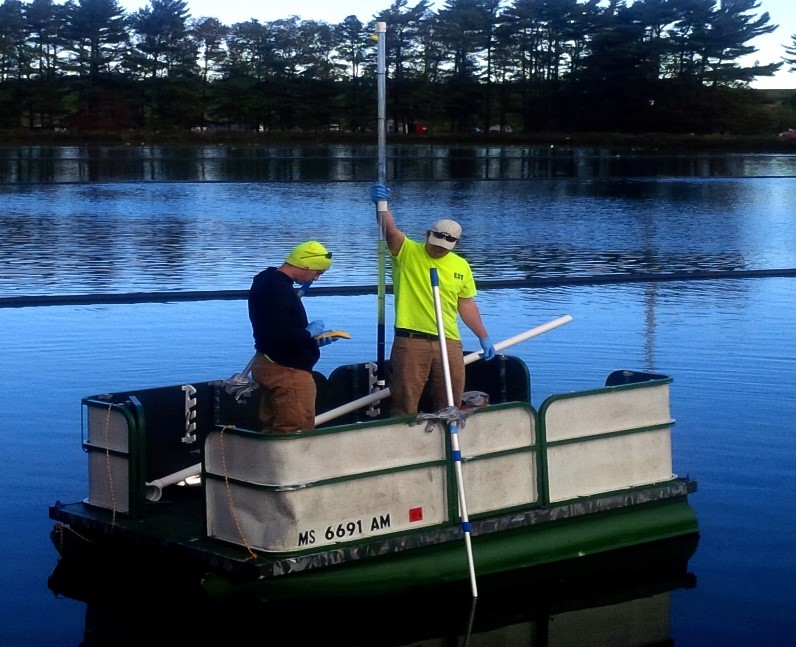
EST’s task was to create a sampling grid and collect approximately 150 samples to determine the depth of sludge at various locations. In addition to recording sludge depths, EST also recorded GPS coordinates at each point so that each sample point could be dropped into the town’s GIS. This data was used to help the town’s engineer understand how much sludge was in the lagoons and estimate the costs associated to remove it. Two of EST’s senior field technicians collected samples across twenty acres of these lagoons while two others assisted them on shore by helping to set up the grid, move air lines, and record data.
The first challenge they faced on-site was to maneuver around the aeration lines that crossed the lagoon. This meant detaching and reattaching the airlines each time the boat passed by them which proved to be somewhat time consuming. It certain situations, EST was able to cross over or under the lines which was a time saver.

Another challenge was trying to keep the boat in place without anchoring or stirring up the bottom sediments in the lagoon; that would disturb the sludge/sediment and the accuracy of the data. The boat was equipped with an electric outboard motor but 15 mph winds still made it difficult to stay in one location long enough to collect a sample and log the GPS coordinate. A solution was created with a thousand foot floating line was tethered on either side of the pond right along the grid line. The boat was then able to use the line to hold position.
Despite wind and these other challenges, the team was able to conquer this large task in just four days, one day ahead of schedule.
